NEER decided not to deploy during Tropical Storm Imelda, which dropped over 40” of rain on the Galveston-Houston area. The storm developed too rapidly to deploy prior to the event. NEER members from University of Houston and Texas A&M and staff from the USGS Storm Events Group collected measurements of fecal indicator bacteria, water quality, and flow rates.
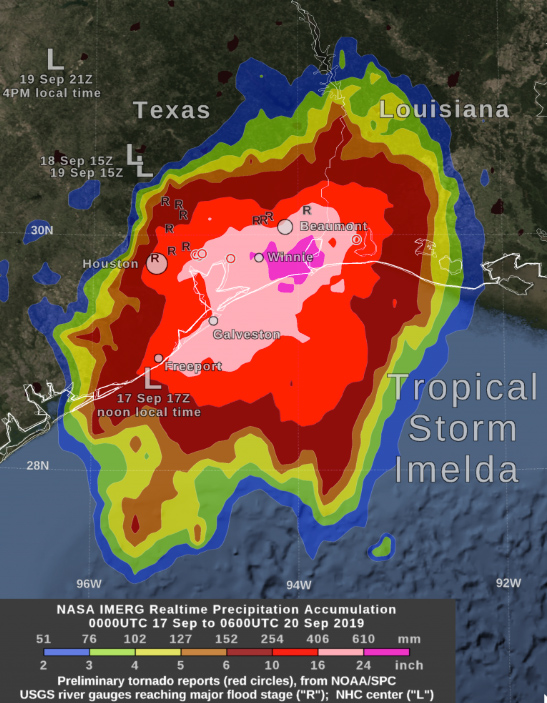
NASA’s IMERG estimated that by Friday morning, September 20, Tropical Storm Imelda had dropped over 24 inches of rain (dark pink) between Beaumont and Houston, Texas. Estimates of between 16 and 24 inches have fallen (light pink) between Freeport and Beaumont, and 6 inches and more (red) over a large area between southwestern Louisiana and Palacios, Texas. Large “L” symbols show Imelda’s location estimated by the National Hurricane Center. An “R” symbol on the image indicates a place where the rainfall from the remnant of Imelda caused a U.S. Geological Survey river gauge to swell to “major flood” stage. Small red circles on this image indicate the location of these tornado reports, as provided by NOAA’s Storm Prediction Center. Credit: NASA Goddard https://blogs.nasa.gov/hurricanes/tag/imelda-2019/

 NOAA
NOAA